Common Challenges in Terrain Modeling and How to Overcome Them

What is Terrain Modeling?
Terrain modeling is the process of creating a digital representation of the Earth’s surface, which captures various topographic features such as elevation, slope, and contours. This modeling is essential for a wide range of applications across different fields, including engineering, environmental management, urban planning, and more.
At its core, terrain modeling involves the use of Digital Terrain Models (DTMs) or Digital Elevation Models (DEMs). These models provide a three-dimensional view of the terrain, allowing for detailed analysis and visualization. DTMs specifically represent the bare ground surface without any vegetation or buildings, making them particularly useful for understanding landforms and their characteristics.
Importance of Terrain Modeling
- Environmental Management: It helps in assessing watershed boundaries and drainage characteristics, which are vital for managing water resources effectively.
- Urban Planning: Accurate terrain models support infrastructure development by providing insights into how land features will affect construction and transportation systems.
- Agriculture: Knowledge of terrain aids in soil conservation practices and optimizing agricultural productivity through techniques like contour plowing.
- Military Operations: Terrain analysis is fundamental for strategic planning in military operations, influencing troop movements and defensive strategies.
Common Challenges in Terrain Modeling

Terrain modeling is a crucial aspect of various fields, including geography, urban planning, and environmental science. However, it comes with its own set of challenges that can complicate the process. Understanding these challenges and knowing how to overcome them is essential for creating accurate and reliable terrain models. Here, we will discuss common challenges in terrain modeling and provide strategies to navigate these obstacles effectively.
1. Data Quality and Integration
One of the foremost challenges in terrain modeling is ensuring high-quality data. Terrain models often rely on multiple data sources, including satellite imagery, aerial photography, and ground surveys. Each of these sources can have varying levels of accuracy and resolution.
- Challenge: Mismatches in data quality can lead to errors in the final model. For instance, if one dataset has a higher resolution than another, integrating them may result in inaccuracies.
- Solution: To overcome this issue, it’s vital to perform rigorous data validation before integration. Using Geographic Information Systems (GIS) can help visualize source data and identify discrepancies. Establishing common horizontal and vertical datums across datasets also aids in ensuring consistency
2. Processing Errors
The process of creating digital terrain models (DTMs) can introduce errors due to various factors like sensor noise or low contrast in images. These processing errors can significantly impact the accuracy of the model.
- Challenge: Errors often arise during the correlation of stereo images used to derive elevation data. This can lead to gross inaccuracies in terrain elevation.
- Solution: Implementing error detection and correction algorithms during the processing phase is crucial. Techniques such as polynomial fitting or spatial filtering can help identify and rectify these errors early in the modeling process.
3. Model Development Challenges
Developing a terrain model that accurately represents real-world features is complex. Assumptions made during model development, such as uniform slopes or simplified geometric representations, can lead to inaccuracies.
- Challenge: If the model assumes a uniform terrain when it is not, significant features like cliffs or valleys may be misrepresented.
- Solution: Employing advanced modeling techniques that account for terrain variability is essential. For instance, using adaptive algorithms that adjust based on local terrain features can enhance model accuracy
4. Morphological Changes
Terrain is not static; it undergoes continuous changes due to natural processes like erosion or human activities such as construction. These morphological changes can render existing models outdated.
- Challenge: Failing to account for these changes can lead to models that no longer reflect current conditions.
- Solution: Regularly updating terrain models using new data sources can help maintain their relevance. Techniques like time-series analysis of satellite imagery can be beneficial for monitoring changes over time.
5. Uncertainty Assessment
For many users, especially those without technical expertise, interacting with complex terrain models can be daunting. Poor user interfaces can hinder the effective utilization of these models.
- Challenge: Users may struggle with navigation or understanding how to manipulate the model for their specific needs.
- Solution: Developing intuitive user interfaces that simplify interactions with terrain models is essential. Providing training resources and documentation can also empower users to make better use of the tools available
How Civil 3D Can Simplify Terrain Modeling

Civil 3D software is a powerful tool that significantly enhances terrain modeling, addressing many common challenges faced in the field. Here’s how Civil 3D can help overcome these obstacles effectively.
1. Enhanced Data Quality and Integration
One of the primary challenges in terrain modeling is ensuring high-quality data integration from various sources. Civil 3D excels in this area by supporting seamless interoperability with multiple file formats, including LandXML and GIS data. This capability allows users to import and export data effortlessly, ensuring that all relevant information is considered in the modeling process.
2. Advanced Surface Modeling Tools
Civil 3D offers robust surface modeling tools that simplify the creation of digital terrain models (DTMs). The software supports various surface types, including Triangulated Irregular Networks (TINs), which are crucial for accurately representing complex terrains.
3. Error Detection and Correction
Processing errors can significantly impact the quality of terrain models. Civil 3D includes advanced error detection capabilities that help identify inconsistencies during the modeling process. The software allows users to perform comprehensive surface analyses, such as slope and elevation analysis, which can highlight potential errors in the model. By addressing these issues early in the design phase, users can create more accurate representations of the terrain.
4. Regular Updates for Morphological Changes
The Terrain is constantly changing due to natural processes and human activities. Civil 3D enables users to update their models regularly by incorporating new survey data or point cloud information captured through LIDAR or other technologies.
Conclusion
Civil 3D is a powerful tool for terrain modeling, but leveraging its full potential requires experience. Think of ProtoTech Solutions as your go-to partner for overcoming challenges in terrain modeling. With over 20 years of expertise in CAD outsourcing and a team of 100+ professionals, we specialize in delivering comprehensive civil CAD drafting services tailored to your needs. Whether it’s land design and development, topographic surveys, structural detailing, site plan layouts, road network planning, water resource management, or other civil engineering requirements, we have the skills and tools to ensure success.
We pride ourselves on maintaining quality, adhering to industry compliance standards, and offering regular support throughout the project lifecycle. We believe in maintaining transparency throughout the project lifecycle. Our collaborative approach ensures that clients are involved at every step, from initial design to final delivery.
If you’re facing challenges in terrain modeling or need expert civil engineering solutions, ProtoTech Solutions is here to help. Contact us today to see how our expertise in Civil 3D and cutting-edge technologies can transform your projects into success stories!
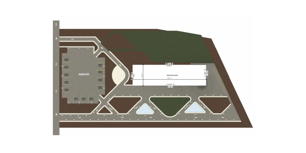
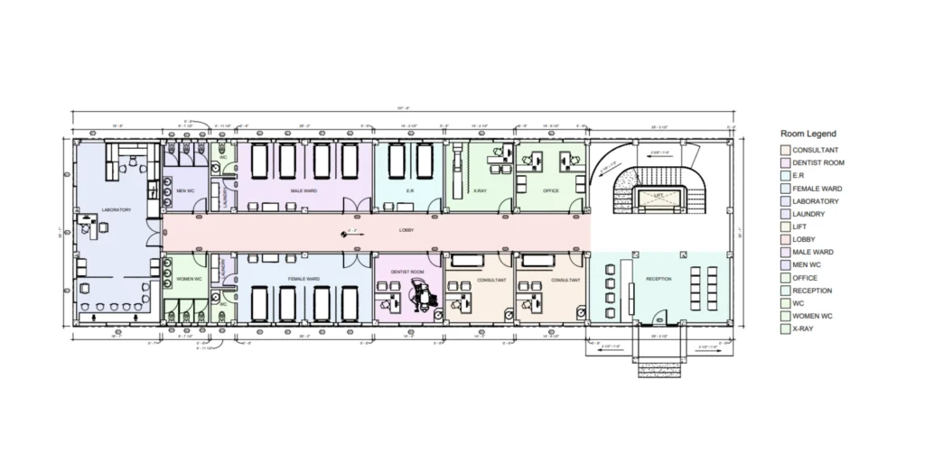
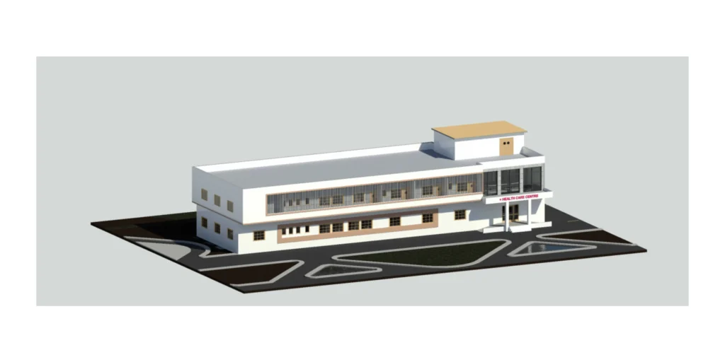
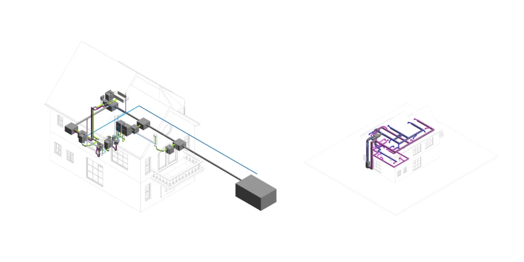
Work Samples