
How Topographic Survey Drafting Helps Engineers Plan Safer Highways and Bridges
Every successful highway or bridge project starts with understanding the ground beneath it.
Inaccurate terrain elevations, overlooked drainage channels, or incomplete site information can lead to design conflicts, unexpected earthwork, and costly construction changes.
Topographic survey drafting helps civil engineers turn field survey data into accurate CAD drawings and digital terrain models. These deliverables provide essential information for planning road alignments, bridge approaches, drainage systems, and construction activities.
By converting field survey measurements, LiDAR observations, and other verified geospatial data into structured engineering drawings and terrain models, topographic drafting helps engineers evaluate existing site conditions before making critical design decisions.
But how exactly does topographic drafting contribute to safer infrastructure?
What Is Topographic Survey Drafting?
Topographic survey drafting converts measured site information into detailed engineering drawings showing existing ground conditions.
These drawings typically include contours, spot elevations, road boundaries, embankments, drainage features, existing structures, and other surveyed elements.
Civil engineering consultants use these drawings to understand terrain characteristics and make informed design decisions before construction begins.
Unlike basic site plans, topographic drawings represent both horizontal locations and vertical elevations, making them particularly valuable for highway and bridge engineering.
1. Improving Highway Alignment and Road Safety
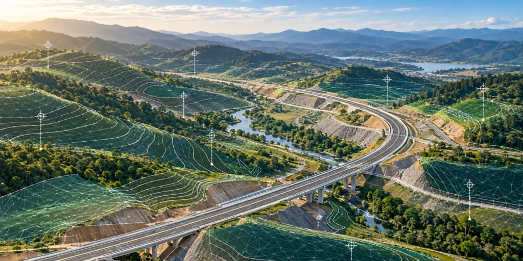
Road alignment directly influences vehicle safety, driving comfort, and construction feasibility.
Accurate topographic survey drawings help highway engineers evaluate existing terrain when developing horizontal and vertical alignments.
They support:
- Road alignment: Identifying suitable routes around steep slopes, natural obstacles, and existing infrastructure.
- Elevation planning: Establishing road gradients and vertical profiles.
- Sight distance: Evaluating terrain constraints affecting driver visibility.
- Earthwork planning: Identifying areas requiring excavation or embankment construction.
For example, in mountainous terrain, a detailed topographic model helps engineers compare alternative road alignments and identify routes that may require less excavation.
The final alignment must still satisfy applicable geometric design and safety standards.
2. Supporting Safer Bridge Design and Approaches
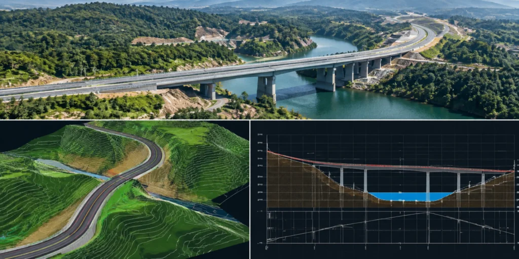
Bridge engineering requires accurate information about surrounding terrain, riverbanks, existing roads, and proposed approach locations.
Topographic survey drafting provides essential site geometry for evaluating bridge locations and connecting roadways.
Engineers use this information to:
- Assess potential bridge crossing locations.
- Plan approach-road gradients and elevations.
- Identify surrounding infrastructure constraints.
- Coordinate preliminary abutment locations.
- Support hydraulic and geotechnical investigations.
Consider a bridge crossing a river valley. If the existing approach elevations are incorrectly represented, engineers may underestimate the height or extent of the required road embankments.
A verified terrain model helps identify these differences during planning, reducing the likelihood of avoidable design changes.
3. Identifying Drainage and Flood-Related Design Constraints
Drainage is a major consideration in highway safety and bridge performance.
Poorly planned drainage can contribute to pavement deterioration, surface water accumulation, erosion, and damage to roadway embankments.
Topographic survey drafting provides essential terrain information for evaluating how water may move across a project site.
Highway Surface Drainage
Surveyed elevations help drainage engineers identify existing slopes and potential low points along a roadway corridor.
Using terrain information, engineers can assess suitable locations for:
- Roadside drainage ditches.
- Stormwater inlets.
- Cross-drainage culverts.
- Surface runoff collection points.
- Drainage outfalls.
- Erosion protection measures.
For example, a roadway passing through a natural depression may require additional drainage provisions.
A detailed topographic surface can help identify the depression and its surrounding terrain before the road profile is finalized.
Bridge Waterway Considerations
For bridges crossing rivers or streams, surveyed channel geometry and surrounding floodplain elevations provide important inputs for hydraulic studies.
These measurements can support:
- Channel cross-section development.
- Floodplain terrain representation.
- Hydraulic model preparation.
- Evaluation of proposed bridge opening arrangements.
- Assessment of potential upstream and downstream impacts.
However, determining design flood levels, scour depths, and hydraulic adequacy requires additional hydrological and hydraulic analysis.
4. Supporting Highway and Bridge BIM Coordination
Topographic survey drafting also contributes to digital engineering workflows.
Civil engineering consultants increasingly coordinate terrain information with roadway models, bridge models, utility layouts, and construction planning data.
Depending on the project requirements, survey information may be delivered as:
- 2D CAD drawings.
- 3D CAD linework.
- Digital terrain models.
- TIN surfaces.
- LandXML files.
- Georeferenced survey datasets.
These deliverables can support integration with civil design and BIM applications.
For example, engineers may use an existing-ground terrain surface alongside a proposed roadway corridor model to review earthwork limits and terrain interfaces.
Similarly, bridge designers can reference terrain information when coordinating abutment locations, approach roads, and adjacent infrastructure.
5. Strengthening Drainage and Flood Planning
Poor drainage can contribute to pavement damage, erosion, water accumulation, and deterioration of roadway embankments.
Topographic survey drawings help engineers understand existing ground slopes and natural drainage paths.
This information supports the planning of:
- Roadside drainage channels and stormwater inlets.
- Culverts and cross-drainage structures.
- Surface runoff collection and discharge points.
- Bridge waterway and floodplain assessments.
For bridge projects, surveyed riverbank elevations and channel cross-sections also support hydraulic modeling.
However, flood levels, design discharges, and scour risks must be determined through appropriate hydrological and hydraulic engineering analysis.
The engineering advantage: Reliable terrain information allows drainage engineers to identify potential water-management constraints earlier in the design process.
6. Improving Earthwork Estimates and Construction Planning
Highway construction often involves significant cutting, filling, and reshaping of existing terrain.
By comparing the existing-ground surface with the proposed design surface, engineers can estimate excavation and fill quantities.
Accurate terrain models also help identify:
- Areas requiring extensive grading.
- Steep cut slopes and embankments.
- Potential retaining wall locations.
- Terrain restrictions affecting construction access.
For example, an incomplete terrain model may overlook a drainage ditch or steep ground transition, affecting preliminary earthwork estimates.
Correctly represented contours, spot elevations, and breaklines help produce more dependable surface models.
These models support planning, although final earthwork quantities require suitable measurement methods and design verification.
7. Reducing Conflicts With Existing Infrastructure
Highway widening and bridge rehabilitation projects frequently involve existing utilities, drainage systems, roads, and structures.
Incomplete site information can create coordination challenges during design and construction.
Detailed topographic CAD drawings help engineers identify surveyed features such as utility poles, manholes, pavement edges, culverts, and retaining walls.
For example, an existing drainage culvert may conflict with a proposed highway widening. When its location is correctly documented, engineers can investigate the conflict during design rather than discovering it during construction.
Buried utilities, however, may require separate subsurface utility investigations because topographic surveys do not necessarily establish their complete locations or depths.
8. Turning LiDAR and Survey Data Into Engineering-Ready Drawings
Modern infrastructure projects often combine total station measurements, GNSS observations, LiDAR, and photogrammetry to capture site conditions.
However, collecting data is only the beginning.
Survey information must be processed, interpreted, and verified before it can support engineering design.
A typical topographic survey drafting workflow includes:
- Reviewing survey data, coordinates, and elevation references.
- Identifying relevant ground points and terrain features.
- Generating contours, breaklines, and digital terrain surfaces.
- Preparing CAD drawings, profiles, and cross-sections.
- Checking drawing accuracy, surface consistency, and project standards.
Depending on project requirements, deliverables may include DWG files, digital terrain models, and LandXML surfaces for integration with applications such as Autodesk Civil 3D or Bentley OpenRoads Designer.
Technical consideration: Incorrect coordinate systems, missing breaklines, or inconsistent elevation datums can affect downstream design. These details should be verified before the drawings are used for engineering calculations.
9. Strengthening Design Verification and Quality Control
Accurate topographic survey drafting requires more than producing visually clean CAD drawings.
Civil engineering consultants need confidence that the information represented in the drawings is consistent with the approved survey dataset.
A structured quality-control process should address several technical areas.
Survey Data Verification
Check that the supplied survey information uses the intended coordinate reference system, units, and vertical datum.
Terrain Representation
Review contours, spot elevations, breaklines, and surface triangulation for inconsistencies.
Feature Completeness
Confirm that important surveyed features, including road edges, drainage structures, and terrain discontinuities, are represented according to the agreed scope.
CAD Standards
Verify layer naming, line types, symbols, annotation conventions, and drawing organization against project requirements.
Drawing-to-Surface Consistency
Where both CAD drawings and digital terrain surfaces are supplied, check that the relevant elevations and geometry remain consistent.
Revision Control
Maintain clear drawing revisions and data references so engineering teams can identify which survey information was used for each design stage.
These checks reduce the risk of drafting-related inconsistencies entering downstream design activities.
10. What Should Engineers Check in Topographic Survey Drawings?
When working with an internal drafting team or an external topographic survey drafting provider, consultants should define the expected deliverables before production begins.
The requirements should address the intended engineering use of the information.
| Quality Check | Why It Matters |
| Coordinate system and vertical datum | Supports accurate positioning and elevation coordination |
| Contours and spot elevations | Helps represent existing terrain correctly |
| Breaklines and surface geometry | Preserves important slopes, edges, and drainage features |
| Existing infrastructure | Supports early identification of potential design conflicts |
| CAD layers and drawing standards | Improves coordination across engineering disciplines |
| Survey references and revisions | Helps teams work with the correct project information |
The necessary accuracy and level of detail should be defined by the project’s design requirements.
Relevant Engineering Standards and Technical References
Civil engineering consultants should align topographic survey deliverables and downstream design work with the requirements applicable to their project location.
- AASHTO — Highway and bridge engineering guidance.
- ASPRS — Geospatial accuracy standards.
- buildingSMART International — Open standards for digital engineering and BIM interoperability.
- Federal Highway Administration (FHWA) — Highway engineering guidance and technical resources.
These references serve different purposes. Geospatial accuracy standards support survey-data evaluation, while roadway and bridge design standards govern the relevant engineering design activities.
Project-specific requirements, local regulations, and the adopted editions of applicable standards must also be considered.
Final Thoughts
Highway and bridge safety depends on many interconnected engineering disciplines, including geometric design, structural engineering, geotechnical analysis, drainage design, construction quality, and long-term maintenance.
Topographic survey drafting provides the terrain information that helps these disciplines work from a consistent understanding of existing site conditions.
Topographic survey drafting is more than converting field measurements into CAD drawings. It provides a foundation for reliable terrain analysis, highway alignment planning, bridge approach design, drainage coordination, and earthwork estimation.
For civil engineering consultants, accurate and well-verified topographic drawings reduce uncertainty during design and help identify potential construction challenges earlier.
While safe highway and bridge design depends on many engineering disciplines, dependable terrain information helps those disciplines make better-informed decisions.
Ultimately, better survey information supports better planning—and better planning contributes to safer, more efficient infrastructure development.
Need Reliable Topographic Survey Drafting Support?
ProtoTech Solutions supports civil engineering consultants with topographic survey drafting, highway and bridge survey drawings, terrain modeling, and survey data-to-CAD conversion. Our drafting team helps prepare structured engineering deliverables aligned with project requirements, CAD standards, and quality-control procedures.
Explore Our Land Survey Drafting Services
Frequently Asked Questions
Q. Why is topographic survey drafting important for highway construction?
It provides accurate ground elevations, contours, and existing site features needed for roadway alignment, grading, drainage planning, and earthwork estimation.
Q. How does topographic drafting help bridge engineers?
It provides terrain and elevation information for evaluating bridge locations, planning approach roads, coordinating abutment locations, and supporting hydraulic studies.
Q. Can LiDAR data be used for topographic survey drafting?
Yes. Properly processed and validated LiDAR data can be used to create terrain models, contours, cross-sections, and CAD drawings for highway and bridge projects.
Q. What software is commonly used for topographic survey drafting?
Civil engineering teams commonly use applications such as Autodesk Civil 3D, Bentley OpenRoads Designer, and other CAD or civil engineering platforms to develop topographic drawings, terrain surfaces, profiles, and cross-sections.
Q. What information should civil engineering consultants provide when outsourcing topographic survey drafting?
Consultants should provide the available survey data, coordinate reference information, required accuracy and drafting standards, drawing templates, expected deliverables, and intended engineering applications. Clear requirements help ensure that the completed drawings are suitable for the design workflow.